Brazil’s 2024 fires drove historic emission levels
The aim of this policy brief was thus to estimate gross greenhouse gas emissions caused by the 2024 fires in Brazil and highlight the relevance of this component in the country’s emission profile. To this end, we disaggregated the analysis of fire-affected areas by...
Financial statements – 2019
2019 financial statements and independent auditors' report.

They Are not Numbers. They Are Lives! COVID-19 threatens indigenous peoples in the Brazilian Amazon
The scenario of infection is severe. The mortality revealed among the indigenous peoples of the Amazon today is the harbinger of a situation that can be catastrophic if an urgent and adequate strategy for treating these populations is not implemented within these...
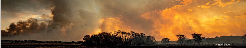
The Amazon in Flames: Deforestation and fire in the Amazon during the COVID-19 Pandemic
A deforested area of at least 4,500 square kilometers in the Brazilian Amazon, three times larger than the city of São Paulo, Brazil, is ready to burn. The result of the sum of what was felled in the first four months of last year—still not burned. This fallen...
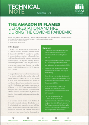
The Amazon in Flames: Fire and deforestation in 2019 and what’s to come in 2020
With the most intense season of deforestation in the Amazon approaching, it is time to evaluate what happened in the region in 2019. It is also time to put strategies in place to combat deforestation, which in the first three months of this year increased...
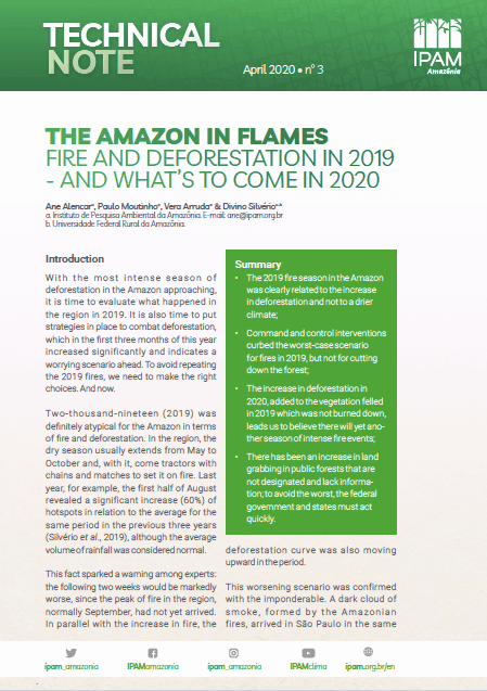
Amazon – land tenure
Map with land tanure distribution in the Legal Amazon - protected areas, private properties, undesignated public lands, rural settlements - based in 2018 data.
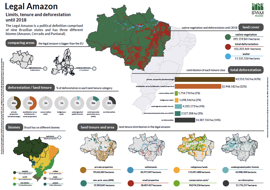
Fact sheet about the Amazon – 2019
Those maps provide information about the Amazon, political definitions and deforestation for each kind of land tanure, based in 2019 data.